
Get a preview of Flint Public Art Project’s murals using this interactive map
For all of you who want more of an immersive experience in the Flint Public Art Project’s mural campaign — but don’t actually want to leave your seat — here’s an interactive map with photos to find out more about each individual mural. Each pinpoint includes information including the location, address, artist, date completed, and a link to see more of the artists’ work when available.
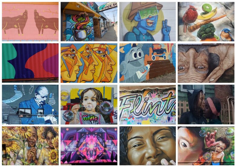
FLINT, Michigan—For all of you who want more of an immersive experience in the Flint Public Art Project’s mural campaign — but don’t actually want to leave your seat — here’s an interactive map to get a sneak peak at the murals and their locations.
Created with Google Maps, you can also find out more about the artist behind each creation.
Simply click on any of the map pinpoints to find out more about each individual mural. Each pinpoint includes information including the location, address, artist, date completed, and a link to see more of the artists’ work when available.
You can also see to routes developed by Flintside (with help from MapQuest Route Planner) to see all the murals for yourself. The downtown route includes an easily walkable excursion with 16 murals in just 2.1 miles.
Related story: Wave of new murals position Flint as one of world’s top destinations for street art
Related story: Here’s how you can see all 40-plus new murals in Flint in a single road trip
Author

Related Articles

Cinco de Mayo Celebration takes over Buckham Alley in downtown Flint
Latinx’s Cinco de Mayo Celebration brings Mexican culture to heart of Flint.

Laughs, Listings, and Lights: The Rise of Veronica Douglas
Veronica Douglas blends comedy and real estate while building her brand and voice in Flint.

George Lopez on Legacy, Instinct, and Taking the Stage in Flint
George Lopez reflects on comedy, resilience, and trusting your instincts ahead of Flint show.


